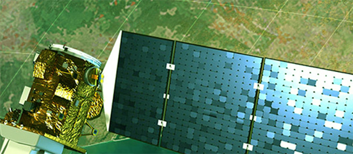
Satellite technology allows you to move forward with data you know is accurate and reliable, helping with more precise loss adjustment processes, reports and index-based models for your clients.
3 Crop Insurance Enhancements with Satellite Technology
Thomas Neher | Geosys
Some may argue that crop insurance is a farmer’s most important risk management tool. With uncertainty in crop production constantly looming, insurance is something secure; a safety net for the unpredictable. However, in the United States in particular, profit margins for ag insurance companies are becoming narrower over time due to insurers needing to react faster and more precisely to the volatility and advancements in agriculture.
Ag technology is continually evolving and it’s essential that crop insurers evolve with it to remain reliable and progressive. Providing clients with advanced data and views of their fields is no longer a luxury, but an expectation that insurers use technology to help manage risk. Satellite imagery can help develop your crop insurance business in three essential ways: increase operational efficiencies, manage exposure to risk and provide substantiated validation.
1. Eyes in the sky, less boots on the ground
Insurers are always looking for ways to increase efficiencies and lower operating costs, especially since farmers are constantly relying on the output.
According to Calem Hoffmann, an agronomist with Agri Business Consulting Group, an Australian loss adjusting firm and Geosys customer, anything that improves efficiency and accuracy is worth the investment. “The satellite-based tool that we use through Geosys allows us to input a field boundary following a ground survey, which instantly provides us with data that is beneficial in validating our assessment. Previously, it often took many days and personnel to obtain that type of data. Satellite imagery not only increases our ability to identify certain agronomic variables, but also reduces the cost and time required to accurately quantify a loss.”
Satellite technology provides both historical and current perspectives of your local conditions versus needing to send team members out to scout every area. Imagine rather than having a new field to scout and having no reliable background, you have access to 30 years of reputable, historical field data. With this information, insurers can prioritize the necessary field visits and simplify the claims management process. The data also enables you to quickly and confidently validate loss adjustment claims with reliable third-party data.

2. Your risk management tool
Farmers come to you for risk management, but who has your back? Satellite imagery provides advanced levels of insight so you’re able to plan and manage your financial risk.
Satellite technology allows you to receive real-time updates of anything that’s occurring in your clients’ fields, providing you the ability to monitor any severe weather conditions and properly manage cashflow to pay eventual indemnities, versus waiting to react to situations. Satellite imagery is also able to cover larger areas in less time to provide a complete overview of one’s fields, giving you peace of mind regarding the decisions you’re making.
“NDVI imagery allows us to confirm the impact of a particular peril, including hail, chemical overspray, waterlogging and drought, which may have influenced the growth and development of a specific crop. With NDVI imagery, we are able to use the data to further support the quantification derived from in-field assessment,” said Hoffmann.
Connacht Tribune reported about satellite imagery being used to detect illegally burned land in Ireland. Illegal burning on agriculture and forestry land led to a serious outbreak of forest fires, and satellite imagery was used to detect which land was illegally burned. Without the use of historical satellite imagery, the ability to distinguish between the illegal burning and accidental burning may not have been possible, and certainly not as quickly, providing an additional level of protection to the insurance companies involved.
3. More accuracy and validation
There are many factors affecting yield and plant growth and many ways to measure them, however the best information comes from the plants themselves — think of them as tens of thousands of sensors per hectare. Satellite imagery is used to give you an accurate and unbiased view of a crop’s status and potential, and therefore your business potential, by analyzing information directly from the plants.
Hoffmann added, “Due to the spatial variability inherent with crop growth, there will always be a level of inconsistency associated with physical counts. However, the use of technology, such as satellite imagery, allows for a higher degree of accuracy when quantifying a loss. Accuracy is key.”
Satellite technology allows you to move forward with data you know is accurate and reliable, helping with more precise loss adjustment processes, reports and index-based models for your clients.
Satellite imagery can provide you with a greater view of your business and what’s occurring in your client’s fields. Take a look at our white paper to learn more about how satellite technology can benefit your insurance business. It might just be the additional perspective you need.
Geosys
We supply real-time, satellite- and weather-based data to clients across the agriculture industry and around the globe.
Our unique combination of expertise — in agriculture, IT and GIS — is the core of our identity, and our commitment to clients. It gives us a clear vision of the high stakes and rapidly changing landscape of the entire agriculture industry. It also allows us to help clients see hidden opportunities in their own business.
We offer a proprietary suite of ready-to-deploy tools that can include varying levels of customization to meet your needs. Additionally, we work with partners to create customized, scalable solutions to give them a unique competitive advantage in their markets and to help improve their business processes.
The content & opinions in this article are the author’s and do not necessarily represent the views of AgriTechTomorrow
Comments (0)
This post does not have any comments. Be the first to leave a comment below.
Featured Product

