AgReliant Genetics and SlantRange Announce Partnership on Next-Generation Aerial Phenotyping Platform for Agriculture
The new partnership will apply SlantRange aerial plant measurement and analytics technologies to enable new levels of efficiency and scale for AgReliant’s seed solutions pipeline.
AgReliant Genetics, the third largest seed corn company in North America, and SlantRange, a leading provider of remote sensing and analytics systems for agriculture, announced today a partnership to integrate SlantRange's Aerial Phenotyping solution into the AgReliant seed breeding technology platform.
"As part of our ongoing commitment to bring the highest impact and most productive seed solutions to market for our customers, we are excited to partner with SlantRange to dramatically expand our ability to accurately and efficiently monitor plant traits in our field trials," said Peter Lynch, Ph.D., Vice President of Research, AgReliant Genetics. "SlantRange's broad suite of validated analytics coupled with their robust intellectual property portfolio for aerial measurement technologies made them an ideal partner as we continue to expand our research and development platform."
The SlantRange Aerial Phenotyping platform provides a turnkey solution to accurately measure and track a variety of agronomic traits for each and every plot of a field trial using multispectral sensors on autonomous drones. The system provides calibrated metrics and statistics ranging from plant count and size measurements to plant health and vigor, which are tracked across the course of a season to provide a comprehensive model of crop performance. The automated workflow combines planter information with in-season measurements, generating plot-level data to guide decisions on hybrid breeding, genetics, advancement, and commercialization.
AgReliant has partnered with SlantRange to implement custom automation and enterprise integration features to provide a seamless data flow from the field measurements to the AgReliant trial management and genetics database. By adopting this leading technology, AgReliant is replacing time-consuming, sparse, and often subjective human measurements with efficient, quantitative, and highly scalable automated measurements to advance and accelerate their research and breeding programs. Coupled with the access to independent globally-positioned research facilities and germplasm through the AgReliant parent companies — KWS and Groupe Limagrain — the SlantRange Aerial Phenotyping platform will further enhance AgReliant's ability to bring the most competitive seed products to market throughout the U.S. and Canada.
"Our team at SlantRange is dedicated to providing unique and high-value remote sensing and analytics capabilities for research, breeding, and production agriculture applications, so we're thrilled to be partnered with AgReliant to build and scale their next-generation technology platform upon our Aerial Phenotyping solutions," said Michael Ritter, SlantRange CEO.
About AgReliant
AgReliant Genetics offers corn, soybean, sorghum, and alfalfa seed solutions to farmers through their product brands. Contact your local AgriGold®, LG Seeds®, or PRIDE Seeds® representative for more information.
About SlantRange
SlantRange is an agricultural intelligence company that develops and markets sensors and analytics systems designed specifically for the needs of agricultural users. SlantRange gives growers, agronomists, and researchers more control over agricultural land, helping to reduce operational costs and improve decision making. To learn more, please visit http://www.slantrange.com.
Featured Product

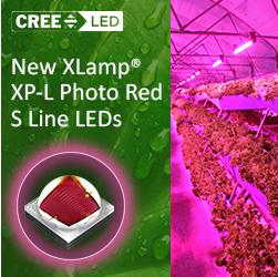
XLamp® XP-L Photo Red S Line LEDs Set a New Standard in Horticulture Lighting
Designed to deliver exceptional efficiency, unmatched durability and seamless system upgrades, XLamp XP-L Photo Red S Line LEDs are optimized for high-performance applications in greenhouses, vertical farms and other large-scale growing operations. These LEDs achieve an impressive typical Wall-Plug Efficiency (WPE) of 83.5% at 700 mA and 25°C. This efficiency allows horticulture luminaires to deliver the same output with less power consumption, translating into lower operating costs and optimized designs that use up to 35% fewer Photo Red LEDs. Cree LED's XP-L Photo Red LEDs, built with advanced S Line technology, set a new standard in sulfur and corrosion resistance, offering an extended lifespan and reliable performance. These features significantly reduce maintenance costs while providing consistent, high-quality lighting throughout critical growth cycles. Additionally, a consistent platform offers easy integration with a drop-in replacement for existing XP-based luminaires eliminating the need for reengineering due to footprint changes. With the same 3.45 x 3.45 mm XP footprint as the XP-G3 Photo Red S Line LEDs, the XP-L Photo Red ensures a hassle-free upgrade for existing designs.
